

History
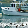
The stories of Phippsburg are rich and wonderful and weave back through the earliest history of Maine like a beautiful dream. Rugged coasts, sweet smells of spring lilac, summer rains, and salt air, fishermen tending their lobster traps, boys fishing from the docks...
With the mighty Kennebec River on her eastern shores (the mightiest and longest river in Maine), the beautiful and placid New Meadows River to her west, and the brilliant, bountiful waters of the Atlantic Ocean to her south, Phippsburg has always been one of the best kept secrets in New England.
The Popham Colony, on the eastern edge of the peninsula was colonized in 1607 by early European settlers. The first European built ship, the pinnace Virginia of Sagadahoc, was built right here on our shores. Archeological teams (led by Dr. Jeffrey Brain of the Peabody Museum in Salem, Massachusetts) have unearthed artifacts from the original site. Following, is information gathered over the years from a number of resources.
About four hundred years ago…
The First New England Expedition
1603
King James of England, James I (only son of Mary, Queen of Scots) began reign.
Capt. Thomas Hanham (grandson of Sir John Popham, Lord Chief Justice of England) and Martin Pring (Shipmaster/Navigator from Bristol, England) explored the waters around Phippsburg..
1604
Sir Ferdinando Gorges appointed governor of Plymouth. He was a friend of Sir Walter Raleigh and was interested in Raleigh plans for colonization in the New World.
1605
Expedition sent to explore New England.
March
Captain George Weymouth (Englishman) explores “Sagadahoc” at mouth of the Kennebec River. He told tales of “harbors by the hundreds, innumerable fish of great bigness and huge mussels with pearls.”
July
Sebastian Champlain (France) explores the area.
late July
Capt. Weymouth returns to England with five captured Indians. They included Indian Chief Nahanada (chief of a group of about 100 Indians), Skidwarres (aka Sketwarroes, from the Kennebec area), Manida, Assacamencl, and Tafquantum (aka Tisquantum, aka Squanto). Sir Ferdinando Gorges took three of them, Manida, Skidwarres and Tafquantum, into his home, teaching them English, and learning as much as possible about their home lands.
1606
Sir John Popham (Lord Chief Justice of England) and Sir Ferdinando Gorges petitioned for Virginia Charter to explore the area around Phippsburg. The Plymouth and London companies were incorporated. These included all territory extending 50 miles inland from 35 to 45 degrees north latitude. The Plymouth company had the northern portion. The company was authorized to govern the area for 21 years. They had permission from England to impose taxes and coin money.
August, 1606
Capt. Henry Challons sailed the Richard with a crew of 29 English to establish a base settlement and site for a colony. The plan was to send additional colonists the following year. He traveled with two unknown native Indians.
October
Thomas Hanham, grandson of John Popham, and Martin Pring leave for New England. Before returning to England they visited the Kennebec River area looking for suitable places for a colony. Indian Chief Nahanada most likely traveled with them.
November 10
Capt. Henry Challons captured at sea by Spaniards. He had orders to take the northern route to New England, however sailed southward via the Canaries and Caribbean and was captured (along with Chief Nahanada) by Spaniards off the Florida coast.
1607
May 31
A second expedition was sent out from Plymouth. The first colonists under charter went to Jamestown, Virginia, the second expedition went to Sagadahoc aboard two ships - the Gift of God and the Mary and John. The Mary and John departed from Falmouth, England and possibly a third boat as well. The Popham Colony visited Pemaquid on their way to their destination at present day Phippsburg.
Only some of the original colonists are known, mostly officers. They were from Bristol, Exeter, and Plymouth among other cities of England. Among them was the Native American Indian Skidwarres (captured and brought back to England by Capt. Weymouth in March of 1605).
Council Members
- Capt. George Popham, Leader of the expedition, Colony President, kinsman to Sir John Popham, possibly a brother. About age 50s.
- Admiral Raleigh Gilbert, Second in Command, was the son of Sir Humphry Gilbert (half brother to Sir Walter Raleigh). About age 25.
- Capt. Edward Harlow, Master of Ordinance
- Capt. Robert Davies, Sargeant-Major, Capt. of Mary and John.
- Capt. Elis Best, Marshall
- Capt. James Davies, Capt. of the Fort
- Capt. John Elliot, Captain of the Gift of God
- Mr. Robert Seaman, Secretary
- Mr. Gome Carew, Chief Searcher (mines)
Others
- John Havercome, Master of Gift of God
- Richard Seymour, Chaplain
- Edward Popham, nephew of George Popham
- Master Turner, Physician - left colony on 10/6/1607
- John Hunt, Draftsman
- Christopher Fortescue, Shipmaster
- Master Patterson, thought to have been killed by Indians in 1608.
- Mastery Digby, Shipwright
Soldiers, craftsmen, farmers, traders.
June 10
Sir John Popham, Lord Chief Justice of England and promoter of the expedition, dies in England.
June/July
William Strachey, in the book History of the Virginia Company writes of the Colonists arrival at Popham. In excerpts from his writings we find that when the colonists arrived via the Kennebec River, Skidwarres took them to where Indian Chief Nahanada lived in the summer months. The colonists set up camp at the mouth of the Kennebec on the west side. They established laws for the community and began church services. George Popham was elected President of the colony and the carpenters in the group began to build a small boat which would later become known as America's First Ship, Virginia of Sagadahoc. They also built a storehouse, well, some huts and a stockade fort.
Since Capt. Henry Challons had been captured on November 10, 1605 by the Spanish (and Indian Chief Nahanada was with him), the settlers may have known that Nahanada was dead and may have brought this news to the natives when they arrived.
August 4
The colonists sited a head of land which they described as showing white sand and with white rocks and strong tide. They may have been describing the tip of Small Point in Phippsburg.
S.H. Whitney in 1887 in The Kennebec Valley writes of the arrival. According to him they kept outside of the point of land believed to be Small Point and headed toward Monhegan. They anchored near Pemaquid Point and explored the area but Capt. Popham thought it might be better to enter the Kennebec and explore that area. Around the middle of August they entered the Kennebec and anchored. The following day they split up into two groups of about 30 men each, one led by Capt. Popham, the other by Capt. Gilbert. They went as far up the river as Merrymeeting Bay. They couldn't find any area better than their original anchorage so they returned to the ship and the next day everyone went ashore and began to settle the colony. Whitney writes that they built about fifty log cabins, erected a fort and storehouse and built the vessel Virginia of Sagadahoc.
August
Colonists initiate fur trade with the native Abenakis.
August 29
Colonists take formal possession of Kennebec River site.
October 6
Some colonists return to England aboard the Mary and John including the doctor.
October 8
John Hunt draws map. Map is a very accurate drawing including plans for a ditch and rampart, the enclosure containing a storehouse, chapel, guardhouse, and other public buildings, and residences for the colonists. The fort is shown defended by nine guns in a range of sizes. The pinnace Virginia is shown offshore but would not have been completed at the time of the drawing.
about Oct.
Colonists build a pretty 30 ton, 50’ pinnace naming her the Virginia of Sagadahoc.
Dec 13
George Popham sends letter to King James via the Gift of God.
Dec 16
50 men and boys return to England on the Gift of God with 33 masts that they traded along with a cannon for provisions in the Azores. 45 colonists remain.
1608
January
Midnight, fire burns the storehouse. Indians?
February
George Popham dies. Rawleigh Gilbert is chosen leader of the Colony.
February 7
Gift of God arrives in England via the Azores with 50 men and boys.
late winter
Colonists lose 11 men to Abenaki Indian attack. 34 men remain.
Spring
In the spring the first ships with supplies returns. Relations with the Indians has deteriorated.
September
The ship Mary and John brings a message to Rawleigh Gilbert that he has received an inheritance from his deceased brother’s estate. This was the third supply ship to arrive and may not have been unloaded.
October
William Strachey, Historian of the Virginia Co. wrote that the colonists feared the following winters would be as harsh as the first one they experienced and decided to leave on the newly arrived ship. He further stated that they all set sail for England in the new pinnace Virginia.
1610s
Seasonal English fishing stations were probably established at Pemaquid.
1614
Capt. John Smith came to the Coast and explored the Kennebec River mapping the area around Pemaquid. He named the region New England and built seven boats at Monhegan. There were ettlements of fishermen were strung along the coast from Pemaquid to Kittery.
1615-1617
Indian tribal wars left many decimated. The Indian village at Pemaquid was probably destroyed and/or abandoned during Indian wars.
1629
The Kennebec Patent issued by the Plymouth Council to William Bradford. This was a piece of land 15 miles wide on the eastern bank of the Kennebec River.
1621
Samoset, an Indian from the Pemaquid area, welcomed the Pilgrims at Plymouth Plantation.
1622
Edward Winslow was given supplies by Pemaquid area fishermen to help sustain the Pilgrims.
1625-1629
Permanent year-round English settlement was established at Pemaquid.
1639
King of England (Charles I, Second son of King James I) appointed Sir Ferdinando Gorges as Lord Proprietor of Providence of Maine, Governor of New England. This included lands from Kittery to Kennebec and made Gorges the most powerful Englishman in America. The first attempts at a settlement didn’t last. Much remained a vast wilderness. King Charles I named the territory Maine. Gorges built his capitol at York in 1642.
1650
Sir William Phipps, born in Woolwich. Youngest of 26 children. The plantation name of the town was Nequasseag. He was the son of a gunsmith. First he was a shepherd but later was a ship-carpenter and then went to Boston to learn to read and write. He built a boat and worked in commerce as well as treasure seeking. He was the inventor of the diving bell and his family was prominent at St. Kitts as well as England. He salvaged £300,000 in treasure from a sunken Spanish ship off the coast of Haiti in 1687. Many family members were knighted and Sir Constantine Phipps (1655-1723) became Lord Chancellor for Ireland (1710-14). Phipps set up a shipyard on the Sheepscot River in Maine but soon abandoned it because of problems with the native Indians.
The website http://freepages.genealogy.rootsweb.com/~walkersj/JamesPhips.htm has an interesting and lengthy story of the beginnings of Phippsburg and of John and Mary Phipps, parents of Sir William. It gives details on how the Phipps arrived in and founded Phippsburg and of other early settlers.
1653-1656
Thomas Atkins, First settler in Phippsburg. Fisherman, had 10 daughters (all with biblical names). Bought southern end of Phippsburg except for Popham which was separated by a creek at the marsh. The land cost him one beaver skin, a quarter rent of a bushel of corn and a quart of liquor. He bought it from Indian Sagamore Robin Hood.
1658
Clark and Lake of Boston had purchased Arrowsic Island and on the southern end had laid out a town dividing it in ten-acre lots. They also planned streets. Major Clark and Capt. Lake were Boston merchants. They also built a warehouse, several big houses for living and a fort near the water. Many immigrants began to settle the town.
1659
John Parker, II. First white settler of Phippsburg Center. Purchased greater part of the Town of Phippsburg from the Indians. The Indian Sachem Robinhood deeded John Parker Rashegan Island, now known as Georgetown.
Parker also owned the areas around Fort Popham and Parker's Head. He deeded the Parker’s Head area to his godson, John Verine. Popham was deeded to Thomas Clark and Lake.
Clark and Roger Spencer bought the island called Robinhood. A blockhouse was built by them and a few settlers built homes nearby. Then Parker purchased everything in Phippsburg from Indian Robinhood except the Atkin’s lands. .
1660
Reverend Gutch of Salem, Massachusetts buys land now known as the City of Bath from Indians.
John Verine at Parker’s Head had a corn mill and helped Indians when the winters were bad. Ironically, he was killed by Canadian Indians on the Kennebec.
1661
Rev. Ichabod Wiswall came to Phippsburg.
about 1670
Capt. Sylvanus Davis was a member of His Majesty’s Council of Massachusetts Bay, Captain of militia in Gorges Province of Maine, west side of Kennebec River. Capt. He lived in the Meadowbrook area of Phippsburg and had interests in the salmon fisheries. He bought some land from John Parker II and settled at Davis Harbor. He owned property all the way from the Kennebec across to Casco Bay. He also owned Stage Island at Popham and Swan Island. He owned a large piece of land called Madockawando in Damariscotta which he bought from the Indian Sagamore Madockawando. This Indian was the father-in-law of Baron Castine.
Capt. John Rowden, Captain of Militia in Gorges Province of Maine, east side, Kennebec River.
The Town of Phippsburg is known at this time as Harwich. There were 20 families on the west side of the Kennebec, most of them in Phippsburg.
1670
John Drake, earliest settler Small Pt. Hrb.. Fisherman. Married Rachael Atkins, daughter Tom Atkins.
1675
Thomas Purchase’s trading house on the Androscoggin River, Brunswick was raided by Indians. The Indians left a message that other attacks would follow and his family was threatened. Purchase and his family move back to Boston..
Epedemic begins in New England “strange diseases” break out in Native populations.
1676
August
King Phillip’s War. Indians attack - not Phippsburg yet, but very nearby. Indians are incited because of mistreatment and abuse by English and exploitation by the French.
Indians attack Woolwich and Arrowsic Island. The Clark and Lake fort on Arrowsic was hit. The inhabitants were killed and Clark was shot while trying to escape. It has been written that Cpt. Davis jumped out a window and ran away in his long underwear, barefoot, and with the Indians chasing him. Supposedly, an Indian shot at him but it was bird shot and threfore didn't kill him. Some of the bird shot hit him, though and he hid on the edge of the river for two days and nights. An empty canoe floated by and he climbed into it and floated to safety. Refugees on Stage Island saw his hand waving above the railing of the canoe and rescued him from the Kennebec.
John Drake fled with his family after being burned out by Indians. Many other settlers fled also.
1677
Puritans who settled Boston claimed and paid $6,250 for Maine. They sold off over five million acres of forest for 12 cents per acre and kept the territory until Maine became a state in 1820.
1679
Resettlement attempts at south end of Arrowsic Island. First town incorporated on Kennebec on south Arrowsic Island. “New Town” opposite Phippsburg Center. Fort built.
1689-1691
King William’s War - Second Indian War. 500 Indians under the French Commander Burneffe came down the Kennebec River. Newton (New Town) was burned, the cattle and the settlers killed. All settlers not killed fled the Kennebec area.. There was no immediate return.
Capt. Davis was in command of the fort at Casco (now Portland) when the Indians and French officers came down theKennebec. They were joined by forces of the Eastern Indians led by Baron St. Castine, who hated the English because they had driven him from his lands at Castine.
1692
Sir William Phipps appointed First Royal Governor of Massachusetts, Plymouth Colonies, Province of Maine and Nova Scotia. Phipps had just sailed past the coast on his way to Quebec with warships in 1690. The Indians, however, did not attack all at once but began by killing cattle.
Thirty volunteers from the Fort at Portland went up to Munjoy Hill to scout for Indians. Going up the hill there was a lane and thick woods on either side. The Indinas ambushed the volunteers and killed 14 of them. The houses of the village were looted and settlers killed. The settlers that managed to get away ran for the fort. The Indians set fires and the next day attacked the fort itself.
Capt. Sylvanus Davis stated that they fought five days and four nights and many men were killed or wounded. The Indians began to tunnel toward the fort for attack.
Frenchman Baron Castine swore that the articles of surrender would be preformed. Burneffe was in command. However, everone in the fort was killed. The French kept just a few captives, one of whom was Capt. Davis. Capt. Davis said they marched for 24 days, headed for Quebec (carrying canoes), with little to eat other than acorns on the journey.
Once in Quebec, he spoke with the Earl of Frontinac. The Earl was upset that the English were rebels against King Charles because they claimed Prince William of Holland as their king. King Charles had married the daughter of the French king and the Puritans of England had him beheaded and called in Prince William of Holland along with Mary, his wife to begin the rule of William and Mary. Davis claimed the Earl was angry at Burneffe for butchering the settlers. After four moths in Quebec he was exchanged for a Frenchman that was captured by Sir William Phipps.
Fort William Henry - Pemaquid. Sylvanus Davis served at Fort William Henry when it was being built by Sir William Phipps. This fort was strong and built of stone. The French called it “the Heartbreaker” and their Indian allies stamped their feet in rage because of the tough construction.
August 11, 1692
Phips ordered Major Benjamin Church to lead his men to the Penobscot and Kennebec Rivers and to retaliate for raids by destroying the corn and other provisions of the natives. Killing was at the men's discetion, but all captives - men, women and children - were to be brought safely to Phips.
Phipps oversees the construction of Fort William Henry. The plans were for a stone square over 700 feet around, with walls six feet thick at the level of the twenty-eight gun ports. The south wall would face the sea and a twenty-nine-foot high round tower would rise to the west.
1693
Aug. 11
Phip’s Treaty/Treaty of Pemiquid, Pemiquid, ME is signed by Madockawando…several Indians are given as hostages… treaty not accepted by many tribes.
1696
Fort William Henry sacked by the Indians - war continued until 1698. The Indians were so mad about Fort William Henry and Sir William Phips that on August 11, 1693 thirteen Indian Sagamores from the Merrimack River to the Penobscot met Phips at Fort William Henry and entered into a treaty. The Indians promised to release all captives. Capt. Davis was at the fort at the time of the treaty. The following year, 1694, Phips purchased Madokowando, large areas of lands on the St. Georges River.
1696
August 16
Letter, Canada, Monsieur D'Iberville threatens Boston concerning Indian hostages from the Penobscot and Kennebec - France's Indian allies. He states that if the prisoners are not released he will turn English prisoners over to the Indians.
1697
May 31
Report, New Hampshire, Captain John, an Indian, killed by enemy while scouting up the Merrimack River with another Indian and an Englishman. The others were captured and carried to Winnipesaukee.
All Indians were not enemies. Isaiah Addington, Secretary to the Deputies of Maine, “ordered that Lieutenant Thomas Swift, take speedy action to provide sixty or more of the friendly Indians with arms and ammunition to be sent out under a suitable commander again’(st) the common enemy.”
1699
January
Treaty, Maine, war ends in northeast. In New England there is relative peace from 1699 to 1703. Queen Anne’s War began in Europe 1702. Few settlers had time to return to coastal Maine. Tthose that did, suffered. French officers and weapons, and Jesuit Priests were involved in the Abenaki raids.
early 1700s
Boston merchants, the Pejepscot Proprietors, buy huge areas of land in Maine from Indians and others.
The Basin area of Phippsburg settled.
1703
French Indian War - Third Indian War (Queen Anne’s War)
About 26 families are settled on Arrowsic Island.
1714
Old “New Town” site reestablished on Arrowsic Island. Watts built fort - layed out town with 40 houses on ancient “Newtown” lands. Fort stood on Butler’s Cove.
1716
Sylvanus Davis estate sold by John Nelson of Boston to the Fort Augusta Proprietors.
General Court of Massachusetts accepted petition to make a township named “Georgetown” honoring the new King of England, King George I.
Ancient Augusta (Small Point) site becomes settled. Benjamin Purrington was an early settler.
A cart path was cut from Small Point Harbor to the Kennebec.
May
Second settlement was established under Pejepscot Proprietors on Casco Bay side of Phippsburg (New Meadows River area). There was no government, no protection from the Indians and better areas for tide mills further up the rivers. The settlers became discouraged.
1717
Governor Shute of Massachusetts came up the Kennebec River in his boat Squirrel and ran aground where the lighthouse is at Phippsburg Center. All of the Indians helped him. He had come to have a conference to discuss the problems between the lands. The Indians met on Puddlestone Island (now Lee’s) and claimed all of Phippsburg. Governor Shute had Reverend Baxter met with the Indians at Watts Fort for three days to try to come to an agreement. Indian Querenabuilt of Penebscot said that the Indians wanted to live in peace and let the English settle where their predecessors had. Then all the Sachems came with great respect and offered the governor their hands saying that they wanted peace..
1718
Samuel Denny (incorporated Georgetown) deeded land in northern Phippsburg by Stephen Minot.
Dr. Oliver Noyes, Principal Director of the Colony and Wentworth built a stone fort at ancient Augusta (now known as the Aliquippa area of Small Point). Dr. Noyes built the fort a on Lumbard Ledge a little east of shore between the north and south sides of the planned village and next to Noyes farm.
Wentworth and Noyes had bought all of the town including the Indian titles and the Plymouth Patents on behalf of the Pejepscot Proprietors Company. They set up a fishing village at Small Point and called it Augusta. It was a large and successful settlement and the largest one this side of Boston. There were 20 boats working in the fishing buisness and grist mills, and tide mills. Fish was smoked and dried and shipped out to Boston on a ship named the Pejepscot.
Everything went fairly well with the Augusta settlement for awhile then the settlers heard the Indians were coming and everyone sought protection in the fort. The French and Indians came into Phippsburg via the Kennebec, then the Winnegance Portage, down the New Meadows River, out to Casco Bay and around the bend to Small Point and the settlement.. The Fort was attacked in the early morning. One settler was going to fetch water from the well when he was killed. Then the fort was attacked. The wooden roof of the fort was easily set on fire by the Indians with arrows laden with flaming birch bark. Women and children were led to safety by guards onto small boats waiting at the shore and the men in the rear guard escaped also by heading out to sea and returning to Massachusetts. The French and Indians were unable to destroy the settlement completely. Soldiers were sent under the command of Capt. Penhallow, but they soon withdrew, possibly to defend other areas.
The surnames Day, Bliffin and Webber were here before Ancient Augusta in 1716 and the lands they owned were exempt from sales by Lithgow and McCobb.
Deeds in York County record Mary Webber selling her “Uncle John Parker’s lands,” James Webber selling his share, each receiving ten pounds.
Rachael Atkins, one of Thomas Atkins 10 daughters, sold her land to Wentworth and Noyes for about $45. She bought Hermit Island, Cape Small Point from Greggory Mudge and Sheepsgut John (Indians) before her marriage to John Drake. They had a daughter, Martha, and after Rachael became widowed she remarried a Berry, and then sold her lands. Her daughter, Mary, inherited the part of Drake’s lands that included the area now known as Morse’s Mountain and north about a mile and west to Casco Bay.
Thomas Atkins had nine other daughters. They sold land at Popham and along the Kennebec River. Ambrose Hunnewell’s lands where the fort stood were not sold. The land that Sylvanus Davis owned (reaching from one side of the peninsular to the other) was sold by an administrator of his estate. Wentworth and Noyes bought all of Phippsburg except Hunnewell’s at Popham. After the breakup of Fort Augusta, the lands were divided among the owners and they ended up eventually in the hands of William Lithgow of Winnegance and James McCobb of Phippsburg Center. The deeds of settlers before and just after the American Revolution included the names William Lithgow and Sarah Noble (his wife), Stephen Minot, and James McCobb.
James McCobb was a shipbuilder, trader, and land owner. He and his wife, Beatrice Rogers, had 10 children. One became Brigadier General Samuel McCobb, commander of the McCobb Regiment of Lincoln County. Dummer Sewall was the Lieutenant Colonel.
After Beatrice died McCobb married Hannah (Nichols) Miller, a widow. She didn’t like their cabin so James built her a “Mansion in the Wilderness.” Hannah and McCobb had three children: twin girls, Mary and Jean; and, a son, Thomas. Hanna died within a few years of the mansion construction.
After Hanna died, McCobb married Mary Langdon (Storer) (Hill). She had son by a previous marriage. His name was Mark L. Hill. Mark ended up with the mansion after his stepfather, James McCobb died. McCobb’s heir, Thomas McCobb, came home from sea and discovered Mark had inherited the mansion. He was very upset and said he would build the most beautiful mansion in all New England, just for “spite.” The home he built was named tthe “Spite House” and he positoned it directly across from the McCobb mansion..
James McCobb died in 1788. Mary (his mother) gave land for the Phippsburg Congregational Church.
Massachusetts was worried about defense against the French and built a fort or garrison under the granite fort that now is at Popham.
There were four families in the City of Bath at this time.
May 12
Thomas Webber, John Dorrell, Edmund Mountfort, and Benjamin Purrington voted to lay out roads to Georgetown, the great marsh on the west side of Morse’s Mountain, and to North Creek in the current Ashdale area. The marsh, valuable for the rich salt hay there, was divided into lots.
The marsh east of Morse’s Mountain was called the Great Marsh, the one to the west the Little Marsh. Hay was mowed with hand scythes and taken by ox cart to dry before being stored in barns or stacked on the big platforms called staddles. Here the settlers had free food for their cattle that didnt' need any tending or watering to grow.
Settlers here at this time: William West, David Thomas, William Wigger, Samuel Harris, Richard Muzzy and Freeborn, John Dorrell, John Chickrin, a Low, and Benjamin Purrington, Oliver Noyes, Thomas Webber, Richard Haward, and John Penhallow.
November
The General Court denies a petition to make a town called Augusta near Small Point Harbor.
1719
Robert Temple brought over five ships with more than 200 immigrant families.
1723
Jun.21-Aug.15
Indian raid. Five whites slain by Indians at Casco including Capt. Watkins of Piscataqua. Seven Indians held aboard the sloop ‘Endeavour’ Their return was demanded on the threat of war by Francis Brier (Indian) (Francois Xavier?).
1722-1724
Governor Shutos or Lovewell’s War - Fourth Indian War. Final clash between the Indians and settlers on the lower Kennebec. Temporary desertion of the area and Ancient Augusta site abandoned. Within a few years reconstruction begins.
1724
August
English attaceked the village at Norridgewock, Me. Jesuit priest and many Abenaki killed. The English had learned how to fend off the enemy. The Abenaki had several major set backs and lost their Priest.
John Blethen arrives around this time. He has three wives over the course of his life and 27 children.
1725
October 4
“You shall march will all possible speed to Norridgewock to take, kill, and destroy all that you meet.” This was the quote from Lt. Bragdon. With 200 men and fierce Mohawk allies the force set under way.
October 23
The force arrived at the village. Almost everyone was napping. Abomazeen was fishing at the river’s edge. They snuck up on the Indian settlement until they were sited. Indians ran from their teepees as the English shot them. The Mohawks used hatchets, killing many who tried to escape in the river. The Indians then fled to Saint Francis.
It was reported on December 22, 1798 by Col. William Lithgow of Phippsburg, commander of Fort Halifax, that he had “given out stores to the old, blind squaw of Abomazeen who lay about ye fort helpless, being yet ye Governor would have mercy on her in provisions.” She was the wife of Amomazeen Sagamore of Norridgewock
Scalps were valuable and few were overlooked. The Mohawks burned the village including the Chapel. Armed forces destroyed the Indian’s crops and fishing nets. It is reported that Colonel Waldron, under a truce flag, captured 400. Many were sold into slavery and others hung on the Boston Common.
1727
June 21
Committee appointed, Boston to meet with the Kennebeck, Wawenock and Aresgontacook Indians to "ratify a treaty between them and the Penobscot Indians and to settle the question of the Eastern Lands as far as possible to the satisfaction of the said tribes".
July 11-August 3
Conference and treaty, Sabatis, requested the English keep supplies at Brunswick, saying, “in cold winters and deep snows, my men unable to go to fort Richmond, sometimes suffer.”
1734
Col. Arthur Noble built a strong garrison on the north side of the peninsula near Fiddler’s Reach.
1736
The first house of worship known in this settlement was erected near the Noble garrison.
1737
Resettlement attempt at Small Point. Some settlers were three families of Halls, Clark, Wallace, Wyman, James Doughty, David Gustin, Jeremiah Springer, Nicholas Rideout, and John Owens.
1738
January 16
Maj. Samuel Denny hired by General Court to have town meeting, elect officials, collection of taxes.
June 29
General Court enlarged boundaries of Georgetown on Arrowsic Island to include Bath, West Bath, Phippsburg, Arrowsic and Georgetown, naming it “Town of Georgetown.”
December 26
First Town Meeting of “Georgetown.” at Maj. Denny’s. Denny was elected Town Clerk. Five selectmen elected. One was Col. Noble. Hiis daughter Sarah, married Col. William Lithgow - builder and commander Ft. Halifax and later a judge. Maj. Gen. William Lithgow, Jr., son of Sarah and Col. William Lithgow became highest ranking military man from Phippsburg. Lithgow, Jr. was U.S. District Attorney District of Maine in 1789 and twice elected state senator. There were also elections of fence viewers, titheingmen, a constable and tax collector.
1740
There was a new church at the Lithgow farm at Fort Noble and some wanted to call the high northern part of town Prospect. It was called Northampton during the previous century. The southern part of Phippsburg was called Harwich in the 1680s and had customary officers but no legal incorporation.
1741
It had been some time since the settlers returned and started settling at Small Point Harbor, and they found themselves included in the North Yarmouth Grant (which meant they had to go to church in North Yarmouth which was way across the rough open waters of Casco Bay). They requested to be part of the parish of Georgetown and on the petition were names of those in the Small Point Harbor area: Ebenezer Hall, Cyrus Day, Samuel Wallis, Thomas Day, John C. Anderson, Joseph Anderson, William Campbell, John Pierce, Daniel Green, and William Thomas.
August 5
Small Point Neck, now Town of Phippsburg, annexed to and became part of the parish of Georgetown.
1745-1749
King Georges War - Indians urged on by French
1751
Statistics:
Farms on the banks of the Kennebec River (to the east) - 10
Farms around Casco Bay (to the west) - 5
Forts - 2, 1 at Small Point Harbor, 1 at the 1607 Popham Colony’s Fort St. George/Atkins Bay
Sawmills - 2, 1 at Dromore Bay on the Kennebec River, 1 at Hermit Island Small Point Harbor
Homes - 16
1756
Road from Small Point to the Center. Also road starting at Bath, going around the head of Winnegance Creek and ending at Dromore.
1760s
The McIntires were early settlers around the 1760s coming from Massachusetts. They obtained land from Lithgow and the southern tip of Hermit Island was known as Joe’s Head. Small Point Harbor was once known as McIntire’s River with Henry’s Landing on the neck.
Other families in Small Point included Wallis, Pye, Sprague, Wyman, Wallace, and Morse.
1760
The boundary of Lincoln County began at the eastern edge of Casco Bay (Small Point) followed the Casco Bay shore to the New Meadows River across the carrying place to Merrymeeting Bay and then 30 miles up the Androscoggin River.
1761
Jethro Sprague, a tailor from Massachusetts arrives in Small Point Harbor with his son, William Sprague, his daughter, Sylvania, and his wife Bethia Cushing. He was a lumberman and fisherman.
Sprague bought land from Miriam Blethen. She was widow of John Blethen and later married Jethro Sprague’s son, William. Miriam's daughter (by John), Rhoda, married William Wallace of West Point.
William Wallace was from Ipswich, Massachusetts. Hecame to Phippsburg and bought lands south of Henry Totman at West Point from Lithgow and McCobb. Wallace owned all of the peninsular of West Point from Totman’s Cove south to Cat Cove. In 1795 the area was known as Wallace’s Point.
Wallace is said to have common ancestry with Sir. William Wallace the Scottish Chieftain of whom Braveheart was written. He married Rhoda Blethen of the old Day/Blethen family of Small Point and had nine children. They built their home near the current West Point Church.
Many descendents of this first Wallace family still reside in the area and have become highline fishermen well known for their skill and cunning on the sea. For many years West Point had the record for catching the most and the biggest tuna fish along the Maine coast.
Steven Lowell settles in the Basin Area of Sebasco. He owned Cape Small Point through Ashdale (named for the Ash trees). He gave land for the Small Point Church and his family is buried in North creek Cemetery. Revolutionary War solider, Jonathan Morse is also buried there.
1764
Road laid out from Sebasco’s Basin area to Small Point Harbor.
Molasses Act levied taxes on molasses and rum.
From the: Commissioned Officers of Col. Samuel Waldo's Regiment, 1762-7 Taken from the Massachusetts Archive, Vol 99, p. 52.: February, 1764 1st Co., in Harpswell, Isaac Hall, Captain Daniel Wood, Lieut. Ebenezer Toothaker, Ensign.
1766
William Lithgow, Sr. built a house at Pleasant Cove and married Sarah Noble. He was a gunsmith and trader at Arrowsic Island. He later commanded Fort Richmond and Fort Halifax. He llived in Georgetown and was thought to be somewhat of nobility along the Kennebec. The farm has only had a few owners, the Lithgows, and the Morses, and now a family that inherited it from his Morse ancestors.
1767
Henry Totman, Devonshire, England buys land in West Point and Sebasco area from Lithgow and McCobb. He lived above the cliff on the west side of Cushman’s Beach near a fresh spring of water. For about $300 he bought all the land from where he lived across to Casco Bay (New Meadows) including the Sebasco Harbor Resort area. South was the William Wallace land.
Totman had bear problems near his home in West Point. One day a bear took a pig from one of his pens and the bear took off with the pig in its arms headed for Uriah Wallace’s house to the south.
Wallace shot the bear with an old musket that was claimed to be five feet high and over 20 lbs.
This was the same musket that killed a wild cat at “Cat Cove” in West Point, giving it the name.
1773
Capt. Samuel Dalling bought 100 acres and half a sawmill in Phippsburg on Dec.31, 1773 with Theophilus Batchelder from William Lithgow [Lincoln County Deeds 5:31, recorded 7 Jan. 1774].
1775
September
General George Washington decides to capture Quebec and sends an expedition under the command of General Benedict Arnold. Forces arrive on the Kennebec under command of Arnold.
Ten companies, mostly from Maine and Massachusetts and three companies from Virginia totaled 1,100 men. Two of the men that marched and later became famous were Daniel Morgan and Aaron Burr.
After anchoring off Parker Head, Arnold visited at General McCobb’s mansion at Phippsburg Center. Men of McCobb’s regiment were sent to accompany Arnold..
1790s
Roads laid from Dromore sawmill across the center to the Pearcey Road leading to Cox’s Head. Also a new road to Stoneybrook was laid.
1793
Daniel Morse bought Morse’s Mountain then called Mount Ararat. The Morse family owned the property until recent years when it was acquired by the St. Johns.
For years Morse’s Mountain was famous for the cranberry meadow in back of the beach. There was a thriving business and the berries were sent to Bath, Brunswick and Portland by a sloop run by George Pye. Eventually the sea reclaimed the land ending the business.
Salt was made at two areas of town. One at Small Point near Fish House Cove. This was the Lower Salt works with old brick ovens. People would boil seawater in big copper and iron kettles to extract the salt. This was used to salt fish which they shipped out and to preserve game and other foods.
1795
Statistics:
Homes on the banks of the Kennebec River (to the east) - 31
Homes on Casco Bay/New Meadows River (to the west) - 26
Sawmills - 4, 1 at Dromore, 1 at Hermit Island, 1 at Center, 1 at Basin
Grist Mill - built on the site of the old mill built by James McCobb.Set up to saw lumber and card wool.
Dam - 1 at the site of Parker’s Head Road to held waters of tidal basin. Formerly a saltarsh.
1796
Hill & McCobb launched eight ships from 1796 to 1809.
1798
Mark Hill advertises for a schoolmaster.
early 1800s
Much road building.
1802
The present Congregational church at the Center was built.
1805
March 15
Mark L. Hill, William King (Maine’s first governor), Peleg Tallman, and others formed the Bath Bridge and Turnpike Corporation. The purpose of the alliance was to construct a turnpike-road from Bowdoin College to the North Church in Bath over the New Meadows River.
1806
Brick store built by Mark Hill and Thomas McCobb. Razed in 1958.
1812
War of 1812. Nearly 18 vessels put into Small Point Harbor for salt.
1814
January 26
Town of Phippsburg incorporated. First Town Meeting at the brick store.
The town is named for Sir William Phips of Woolwich. Phips lived from 1650-1695. He was the first Royal Governor of Massachusetts and the first American to be knighted by the King of England. He recovered a fortune in sunken Spanish treasure of the coast of the Bahamas near the Turk’s Island.
1814-1921
Statistics
Major Shipbuilders - 3
1 at Winnegance, Richard Morse and Sons (Jacob parker, Alden, John G.I.),
1 at Phippsburg Center, Charles V. Minott, Sr.
1 first at Stoneybrook on Dromore Bay then later at the Center, Frank S. Bowker.
1814-1866
Morrison built 12 vessels at the Mark Harrington property at the Center.
1815
Statistics
Schools - first records of schools, no buildings existed, pupils were taught in homes.
The Sylvester House (1767) held classes for men in the fall and winter and classes for women in the spring and summer.
Early schoolmasters were:
Dromore area - Joseph Donahue
Percy District - Stinson Sewall
Basin area - William Howard
Parker District - John Reed and Eliza Todd
1817-1832
Parker McCobb built six vessels.
1820s
Huge Atlantic salmon sold at Parker’s Head and Parker’s Neck for a penny each.
1820
Lower District School in Dromore.. Upper District School at Pitch Pine Hill - building date unknown.
1821
Meadowbrook schoolhouse built by George Butler. Torn down 1917.
1824
The Diamond Roof School at North Creek, Ashdale, built by Alpheus Foote, William Wallace, William Lowell, and Elias Totman. The first teacher was Nancy Wheeler of Bangor.
1825
Mark Hill removed from office as Collector of the Port of Bath. He had favored the Missouri Compromise seeking entrance of Maine into the Union as a Free State along with Missouri, a slave state. Maine people did not want to enter the union with a slave state and this was the beginning of his demise. In 1819 Phippsburg voted against separation from Massachusetts.
Drummond family owned large lands just beyond the Center Pond on the road to Parker’s Head.
1828
Small Point Free Will Baptist Church built.
1830
Timothy Merritt, Methodist Church of Bath, held services at Upper District School at Pitch Pine Hill.
By 1831
Road to West Point from William Totman’s north line to Uriah Wallace’s house near the Carrying Place.
1831
Free Union Meeting House built at Dromore where the grange hall later stood.
1835
G.W. Richardson paid to board school mistresses and hire for Hunnewell’s Point, Popham.
1836
Aliquippa Inn and Trading Post built. Named in honor of Indian Princess Aliquippa, daughter of Half Moon (Chief of the Indian tribe that harassed Ancient Augusts settlement of 1722).
Land given at Center by Mark Hill to build a brick schoolhouse. This still stands on private property.
First Town Hall or town house built at Center.
Stone Schoolhouse built on Percy land near present day Parker’s Head - Popham Road. This was built as the Percy family had become so large in the area.
1842-1871
Morse shipyard builds 26 vessels.
1846
Free Union Meeting House at Parker’s Head built. Joined Baptist denomination in 1853.
1854
Charles Minot, Sr. buys house at Phippsburg Center.
1859
Second Center school of wood built to replace brick, now the Phippsburg Historical Society Museum.
by 1860
School at Winnegance and Parker’s Neck across the old mill dam from Parker’s Head village.
1860s
Patience and Levi Wallace are early village dwellers in Sebasco from Horse Island (now Harbor Island across from Sebasco Harbor Resort). The island was named Horse Island originally because horses from the ice making business at Cornelius Pond were kept there in the off season.
Total enrollment for schools in 1860 was 982.
1861
Fort Popham begun at the site of Fort at Hunnewell’s Point.
1867
Four sawmills under the same roof lost in fire. Owners: Rollins, Reed, Duley, and Jewell estates.
Joseph Bowker starts building boats at Stonybrook on Dromore Bay.
1870
The population in 1870 was 1,344.
Special Town Meeting - exempted from tax for 10 years and remitted back taxes on the site to anyone or any company who could rebuild the dam and convert it to an ice pond as a means to created business and employment to those that lost out in the fire of the sawmills. John G. Morse I of Winnegance, and a Bath partner, bought the old mill privilege and dam and built a new dam. They started the Parker’s Head Ice Business which was successful through the late 1890s.
1871
Frank S. Bowker started building boats with his son, Walter Bowker.
1877
William Wallace, descendent of one of West Point’s first settlers, deeded land for a school district.
1880s
The population was 1,497.
1882
Town voted to discontinue road crossing the salt marsh (always the principal travel way from Center to Parker’s Head and Popham) at the request of the heirs of the property of Capt. Drummond (he had owned the mill and tidal basin there). Afterwards this area was known as the Drummond Ice Pond.
Ice House Boarding House and storage houses (with a 40,000 tons storage capacity) built at the Center. Near the Center Pond can be seen remains of the old pier where schooners came to load up ice Just past the pier and north is a small cove where the Franks S. Bowker and Son Shipyard were.
1884
Basin Benevolent Association bought land from John Perry and built the Valley or Lower Chapel in Sebasco. It later was destroyed by fire. The Upper Chapel was built about the same time on a hill near the lower chapel. The Upper Chapel was used by a holiness society, then Pentecostal groups, and much later by the Nazarenes who now use the Sebasco schoolhouse which they bought and converted into a church when the current elementary school was built.
1886
Joseph Bodwell and Melvin Spinney buy shore properties at Small Point and start building cottages.
George Lowell bought Rock Garden Inn area.
late 1880s
George Ed Black has a fish wharf and store at Black’s Landing in Sebasco.
1889
Beginning of a Fire Department. The Parker’s Head village citizens bought a 50 year old Hunneman-made Hand Tub for $100. A month later veteran No. 2 acquired 200 feet of new hose.
1892-1896
Popham Chapel - Baptist
1890s
Small Point Club advertised.
1897
New school in the Basin area.
1900
Wild sea duck (coot) sell for a quarter for a pair.
1904
The launching of the Marcus L. Urann was the last vessel launched from the Minot shipyard. Bowker’s shipyard continued operations at least through WW I.
1905
Freemen H. Merritt, New York, contractor, bought and developed property and opened a clubhouse.
early 1900s
From Recollections in A Child’s View of Phippsburg by Colonel John F. Williams, December 28, 1965, Phippsburg Observer:
“As far back as I can remember, each summer a small group of Indians from ‘down east’ pitched their tents beside the walkway that ran from the Haley and Marr store to the Eastern Steamship Wharf. These Indians paddled their heavily ladened canoes into the river, beached them, and unloaded there to set up tents which constitute their camp for the summer. They sold baskets, bows, and arrows, moccasins, toy birch bark canoes, and other items too numerous to mention. Their tents were always filled with the fragrance of ‘sweet grass’ which grew in the Popham area and which was harvested and cured by the Indians.”
One the eastern side of Hermit Island is Webber’s Island, which was owned by famous artist, John Marin around the turn of the century.
1920s
Nathan A. Cushman, New York Baker bought Sebasco Harbor Resort property. The previous owner, Merrill started Rock Garden Inn.
1923
West Point Church begun.
1940s
Sebasco Downeaster Seafoods, Inc. operated at the location of the current Water’s Edge Restaurant.
1950
Hermit Island in Small Point sold by William and Edward Morse to former Governor Sewall who developed it into a large and popular campground. Descendents of Sewall still own the island.
1958
Phippsburg Elementary School built.
1963
November
Baker’s Wharf, Sebasco, blows over in a storm.
early 1990s
Dr. Jeffrey Brain, Archeologist, Peabody Museum, Salem, Massachusetts, learns of the original Popham colony site while vacationing in Phippsburg.
1994
Site of Fort St. George - the original 1607 settlement is confirmed at the tip of Sabino Head near the mouth of the Kennebec River. After several weeks of digging Dr. Brain and his helpers came up with some artifacts from the 1600s and a single “post mold” - the pulverized, underground end of a wooden post (presumed to be of the storehouse).
1997-1998
Annual excavations begin - focus on locating specific structures within the fort. Archeologists interested in finding the storehouse and Admiral Raleigh Gilbert’s house. They wished to determine the accuracy of the map drawn by John Hunt and dated October 8, 1607. The map turned out to be extremely accurate. The form, dimensions, and construction of the storehouse were exactly as drawn by Hunt. Dr. Brain and his assistants find five more post molds.
2000-2002
Archeologists locate the home of Sir Raleigh Gilbert. Among those items recovered are fragments of a 17th century, German, stoneware jug and fancy buttons.
Dr. Brain and assistants find numerous artifacts at the original Popham colony site including: shards of North Devon ceramic from England, salt-glazed Bellamine stoneware from Germany, pieces of bottle glass, fragments of plate armor, a caulking iron, lead musket balls, gun parts, numerous glass trade beads, fragments of liquor bottles, drinking glasses, buttons of glass and beads of jet.
2003-2005
As Dr. Brain continues with his work involving the Popham Colony of 1607, hundreds of people come together to begin planning celebrations for the 400th anniversary of the Popham Colony in Phippsburg.
2006
The non-profit, community-based, volunteer organization, Friends of Phippsburg, is formed. Friends of Phippsburg, the volunteer group Maine's First Ship, and the volunteer group Popham 400th work together and along with the State of Maine, Maine State Museum, Maine Maritime Museum, and local volunteers to prepare, plan and coordinate celebrations for the upcoming Popham 400th Anniversary celebrations in August of 2007.
2007
The Popham 400th Anniversary Celebrations take place in August. Reinactments, entertainment, the biggest fireworks the town has ever seen, craft and food fairs, lobster bakes, parades and more from August 24-26, 2007. Many descendants of the original colony leaders (George Poham and Raleigh Gilbert) came from all around the world to share in the celebrations.
Dr. Brain continues excavations at Sabino Head all the while returning the site to such a pristine state that couples continue to marry at the very spot where the earliest colonists in New England set up camp in 1607.
2010
Dr. Jeffrey Brain returns to Popham for further excavations on the original 1607 Popham Colony Site. Sam White of Auburn purchased the condemned and dilapitated waterfront home sitting on the eastern point of the site and graciously allowed archeaologists to dig on the land. A wealth of new information was discovered.
One of the most important discoveries were the remains of smelters which are used in the process of making nails and tools from raw iron ore. This means the colonists mined the iron ore from somewhere close by and smelted it right on the colony site. This indicates the intent of a permanent colony at Popham and shows us that, though many of the colonists were soldiers, there were also highly trained specialists in their fields and prominent members of society among them.
Also found was what is likely the second oldest coin ever found in Maine, a Queen Elizabeth I silver shilling, minted between 1592 and 1595. Dr. Brain says there was little need for money in the new settlement and no other coins have been found on previous excavations.
2011
Andrea Brand opens the Phippsburg Art & Information center in a big, old renovated barn her partner built 27 years before (and where they first met) on the Sam Day Hill Road in Phippsburg. Designed as a place to promote local art and to serve as an information center for visitors, the barn gallery schedule is seasonal every day from 10-4. Andrea Brand's lineage traces back through 10 generations of fishermen in and near Phippsburg, Maine.
2012
This year celebrates the lives and memories of those forceably removed from their homes on Malaga Island by the State of Maine in 2012. Malaga Island is a 42 acre, heavily wooded island at the mouth of the New Meadows River across from the shores of Sebasco in Phippsburg, Maine. The island is pristine and beautiful, covered in giant red spruce with a two acre field of grass and wildflowers on the north end where there is also a small landing beach. It is abundant with wildlife including the occasional white-tailed deer, moose, red squirrel, osprey, eagle, cormorant, herring gulls, whoop-er-wills, sandpipers, wild berries, and tidal pools filled with treasures from the ocean.
The history of Malaga Island is rich and interesting. An island of descendants of a freed black slave, Benjamin Darling, the former residents (squatters) were driven from their homes by force in the early 1900s in hopes of increasing tourism in the region.
Malago (as the locals call the island) was once inhabited by the descendants of Benjamin Darling. Legend has it that Benjamin Darling was a slave who was given his freedom as a reward for saving his master, Captain Darling in a shipwreck. Though he is believed to have been a slave from the West Indies, DNA of his ancestors has been traced to the Senegal / Gambia region of Africa. Benjamin purchased Harbor Island (just southeast of Malaga in 1794 for 15 pounds.
Benjamin Darling never lived on Malaga Island but his descendants were the first to settle there and on many of the surrounding islands of northeastern Casco Bay. He was married to a white woman, Sara Proverbs, and their children were of mixed race.
The earliest known owner of Malaga Island may have been Eli Perry who supposedly bought the island for $150 in 1818. He never paid taxes on it, and his descendants were later unable to provide a deed for the island. Perry never lived on the island.
The Darlings and Griffins were some of the first to settle on Malaga. By 1880 there were 27 people living on the island in a settlement on the north end. By 1900 there were 40.
By the winter of 1892, the State of Maine began helping the poor of Malaga from the Maine Pauper Relief Fund. Those living on the island were often talked of and portrayed as immoral, and living in unfit conditions. They were of mixed race and quite poor, though, not much more so than many on the mainland.
What was considered the pauper community on Malaga Island was thought to be a deterrent to potential tourism in the region as evidenced by newspaper articles of the time. Those on the mainland related to those on the island dared not speak out for fear they would also be judged immoral or unfit by others within the close-knit fishing communities in Phippsburg.
For five years the towns of Harpswell and Phippsburg fought over who owned the island. Neither one wanted the responsibility of it or the poor living there.
In 1903 the state granted the island to Phippsburg but this was repealed in 1905. The islanders became wards of the state and their fate fell to the jurisdiction of the Governor's Executive Council.
In 1906 the Charles Lane family came to Harbor Island and began to help the poor of Malaga Island. Lucy, Charles Lane's daughter, took an active interest in the children on the island and arranged for the teaching of the island children beginning in 1906 in James McKenney's home on Malaga. By 1909 the first schoolhouse was built on the island and within two years there were drastic improvements in literacy of those who attended.
In the summer of 1911, then Governor Frederick Plaisted and a group of officials visited the homes and families living on Malaga. These officials decided that eight of the islanders were feeble minded. They were placed in the Pineland Center for the Feeble Minded in Pownal, Maine. It is unlikely they were feeble minded, but may have been sick as one of them died of Bright's Disease (kidney failure) within a year of leaving the island. It has also been written, though unconfirmed, that James McKenney may have told the state workers to take the Marks family as they had something that was wasn't catching but that no one wanted to be around. Seven of those deemed feeble minded were from the Marks family.
Three weeks later the descendents of Eli Perry notified those remaining on Malaga that they had just under one year to completely remove themselves from Malaga. The state then bought the island for $471 and paid a small stipend to some of the islanders to assist in their relocation. Remaining structures on the island not removed by July 1912 were burned and the schoolhouse was removed. The remains of those buried on the island were dug up and reburied at Pineland.
In 1913 the island was bought from the state by a man named Everard Wilson. Mr. Wilson was a friend of a Dr. Gustavs Kilgore who was the chairman of Governor Plaisted's three member panel on the executive council committee. These were the same men who investigated the island just after Governor Plaisted took office in 1911.
In 2001 the Maine State Heritage Trust bought the island from a private owner for a nominal fee. Their intent with the island is to protect it from development, to foster low impact recreation,and to sustain the long standing tradition of local fishermen storing their traps on the island in the wintertime.
The trust has led archaeological digs where a wealth of information was found about the island community, has cut and maintained a loop trail on the island, has been a valuable asset in the outreach to those descendants of the original settlers who still live in the area, and has become a proud and deserving steward of the island for generations to come.
In 2012 Kate Higgins McBrien of the Maine State Museum put together an amazing tribute to the families removed from Malaga Island in a museum display that will be there for the public to see and learn from for all of 2012. Artifacts found on the island, giant posters of the men, women, and children who once lived there, census information, and a wealth of information for generations to come. Legislation is being proposed to establish a scholarship fund for descendants of the original islanders.
2014 - HAPPY BIRTHDAY, PHIPPSBURG, MAINE!
This year marks the 200th anniversary of the incorporation of the Town of Phippsburg.
Click HERE for an entire list of the events held last summer.
20015 is shaping up into a spectacular spring after one of the coldest and longest winters in this region. The Barn at Phippsburg Art & Info opens June 13 for Season #5 and this year will showcase the works of the owner and founder, Phippsburg native artist, Andrea Brand.
Sebasco Harbor Resort has renovated their Sea Chest Gift Shop into a brand new little cafe featuring the works of many local artists. The resort has long been a supporter of local arts and for the past two seasons, in liasion with Phippsburg Art & Info, they have sponsored local art shows in their Ledges Pub. This resort is one of the first and longest standing businesses in Phippsburg and is an important source of summer employment for locals.
Spinney's Restaurant, Guesthouse & Cottages, Anna's Water's Edge Restaurant, Hidden Mountain Cottages & Gift Shop, Bisson's Center Store, The Farmer's Market, Edgewater Farm B & B, North Creek Farm, Hermit Island Campgrounds, Percy's Store, 1774 Inn, Head Beach Campgrounds, Meadowbrook Campgrounds, Oceanview at Popham, and other local businesses do a wonderful job of doting on the many tourists and old friends who come to visit each summer.